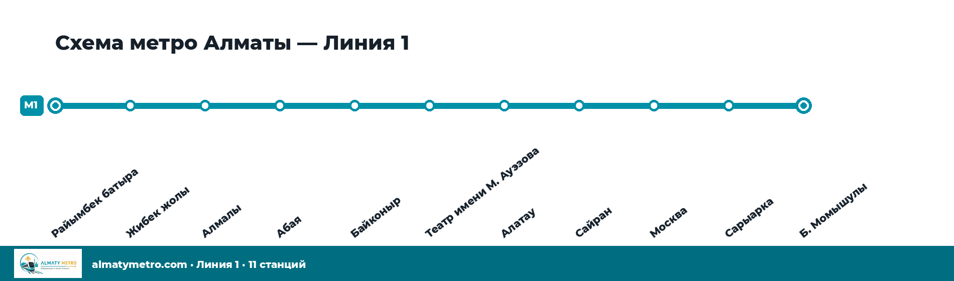
Line 1 and all 11 Almaty metro stations on a single map — view it online or download the PDF.
Updated: September 2026
The metro line map
The map shows the single Almaty metro line and all its stations. It is based on material from Wikimedia Commons and reflects the situation as of July 2026.
Almaty metro map · Wikimedia Commons
Download the metro map (PDF)
The vector PDF stays sharp in print and on a phone screen, and works without an internet connection.
The Almaty metro opened in 2011 with seven stations. Sairan and Moskva were added in 2015, and in 2022 the line was extended to Saryarka and Baurzhan Momyshuly. If you have an old map, check the current termini of the line below.
Line
Route
Change
1
Raiymbek Batyr – Baurzhan Momyshuly
The only line. Opened in 2011, extended in 2015 and 2022.
The map reflects the situation as of July 2026. Service arrangements can change — check the official information at metroalmaty.kz.
🔖
Add this page to your bookmarks
We update Almaty Metro as soon as anything changes — timetable changes, service disruptions, fare changes and important notices. Save the page and check it before you travel so you always have the latest information.